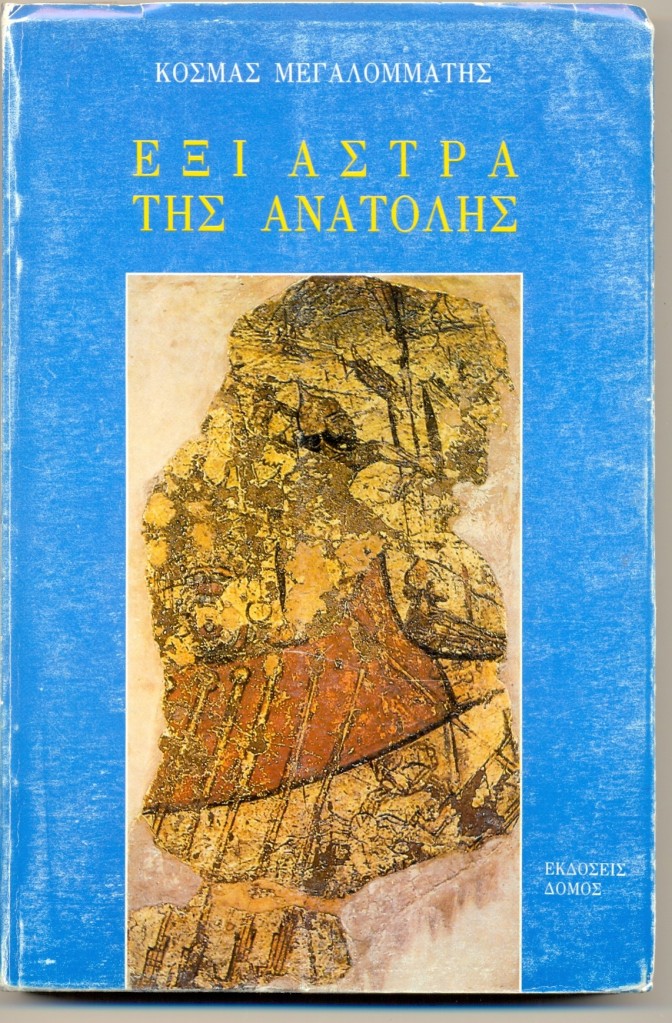
Αναδημοσιεύω εδώ το πρώτο από τα έξι κεφάλαια του βιβλίου του Έλληνα Ανατολιστή ‘Έξι Άστρα της Ανατολής’ (εκδ. Δόμος, Αθήνα, 1994). Αποσπάσματα του κεφαλαίου μαζί με επιπρόσθετες φωτογραφίες είχα αναρτήσει πριν από σχεδόν δέκα χρόνια ως βίντεο. Αναρτώ εκνέου το εν λόγω βίντεο, καθώς και το εισαγωγικό κείμενο που είχα τότε γράψει. Σε κάποιες από τις αναρτήσεις του βίντεο σε ρωσσικά σάιτς θα βρείτε αποσπάσματα από βιβλιοπαρουσιάσεις του συγκεκριμένου βιβλίου στα αγγλικά και στα ρωσσικά.
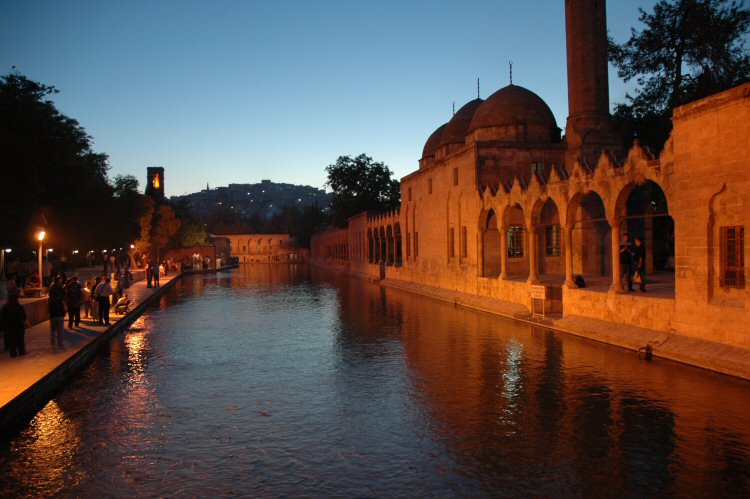
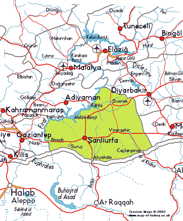
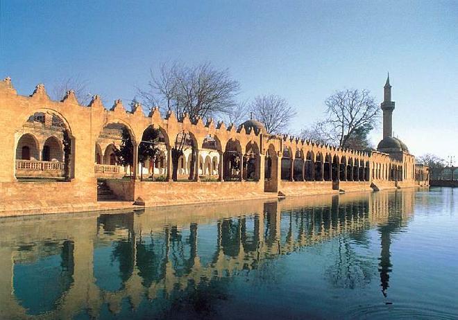
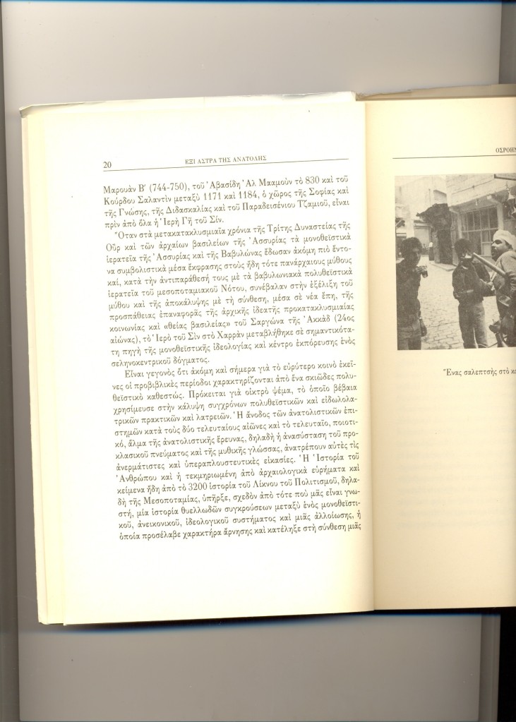
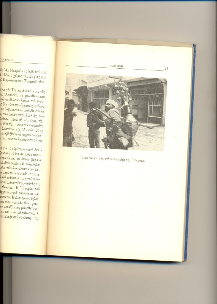
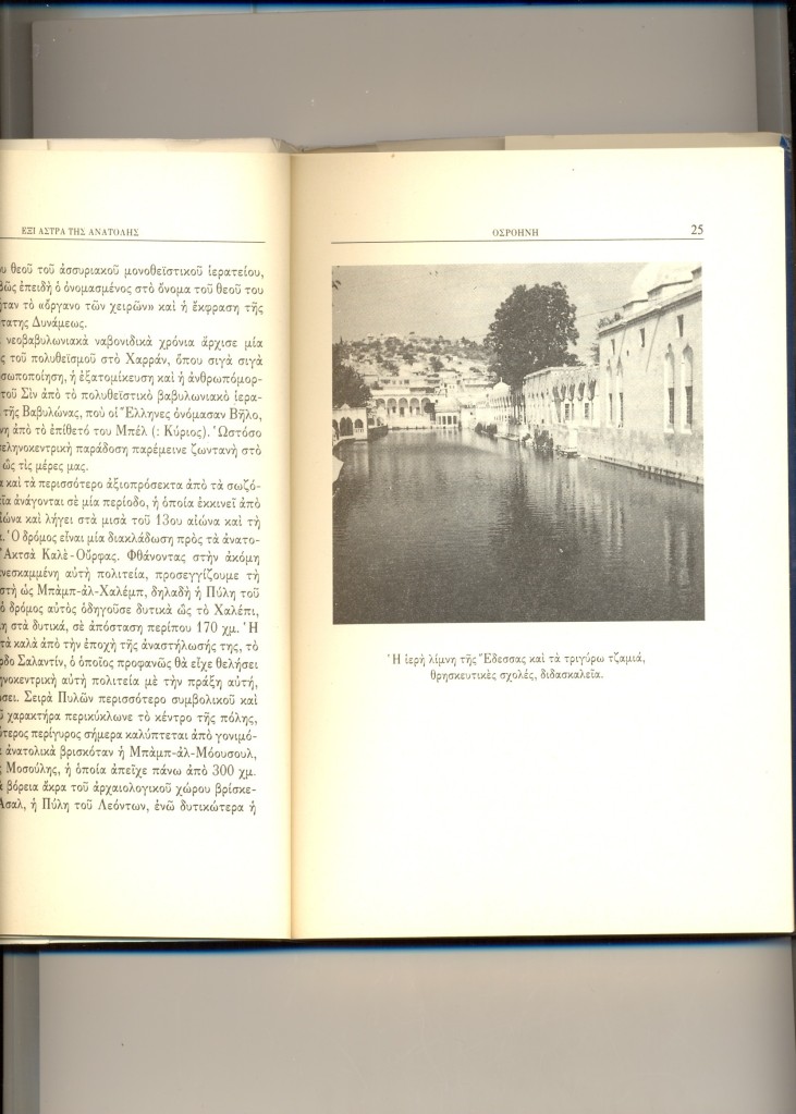
Η Έδεσσα της Οσροηνής (αραμαϊκά: Ουρχόη) είναι σήμερα μια από τις μεγαλύτερες πόλεις και πρωτεύουσες νομού της νοτιοανατολικής Τουρκίας, μόλις 50 χμ από τα συριακά σύνορα και σχεδόν στο μέσον του μήκους τους. Στα τουρκικά λέγεται Ούρφα (Urfa) ή και Σανλί Ούρφα (Şanlıurfa), δηλαδή Ένδοξη Ούρφα, επειδή οι στρατιώτες του Κεμάλ Ατατούρκ την είχαν αποσπάσει από τους επιτιθέμενους Γάλλους αποικιοκράτες.
Δείτε το βίντεο:
Έδεσσα της Οσροηνής (Ούρφα της ΝΑ Τουρκίας): από το Βιβλίο Έξι Άστρα της Ανατολής, του Μουχάμαντ Σαμσαντίν Μεγαλομμάτη
Περισσότερα:
Δεν υπάρχει βιβλίο που να με έχει εντυπωσιάσει περισσότερο από το ιστορικό – θρησκευτικό περιηγητικό του Κοσμά (νυν Μουχάμαντ Σαμσαντίν) Μεγαλομμάτη «Έξι Άστρα της Ανατολής» το οποίο διάβασα πρόσφατα στο Ιντερνέτ. Η μόνη έκδοση του βιβλίου από τις Εκδόσεις Δόμος έχει εξαντληθεί και ο πιο εύκολος τρόπος να διαβάσει κάποιος το εκπληκτικό αυτό έργο είναι να κάνει ένα κλικ εδώ: https://6astratisanatolis.wordpress.com/
Και το πρώτο κεφάλαιο περί Οσροηνής βρίσκεται εδώ:
Δεν νομίζω να υπάρχει στην Ελλάδα ένας, έστω ένας, επιστήμονας ή διπλωμάτης που να γνωρίζει την Τουρκία, την ιστορία της, το παρελθόν και το παρόν της τόσο βαθειά και τεκμηριωμένα όσο ο Μουχάμαντ Σαμσαντίν Μεγαλομμάτης.
Καθώς είχα την τύχη να γνωρίζω κάποιους από τους καλύτερους προσωπικούς του φίλους οι οποίοι πρώτοι μου μίλησαν για το βιβλίο, έχω πρόσφατα επικοινωνήσει μαζί του και του ζήτησα την άδεια να δημοσιεύσω υπό τη μορφή βίντεο επιλεγμένα κομμάτια από το βιβλίο του αυτό, καθώς και τις φωτογραφίες του. Τον ευχαριστώ ιδιαίτερα για τη συγκατάθεσή του.
Το βιβλίο κυκλοφόρησε στις αρχές του 1994 αλλά γράφηκε τμηματικά από το 1989 μέχρι το 1992. Ο Κοσμάς Μεγαλομμάτης είναι επίσης ένας εξαίρετος φωτογράφος και οι φωτογραφίες που δημοσιεύονται στο βιβλίο είναι όλες δικές του. Μετά από μεταπτυχιακή εξειδίκευση σε ασσυριολογία, αιγυπτιολογία, ιρανολογία και ισλαμολογία, ο Κοσμάς Μεγαλομμάτης πέρασε πολλά χρόνια εξερευνώντας και μελετώντας αρχαιότητες και μνημεία σπιθαμή προς σπιθαμή στην Τουρκία, τη Συρία, το Λίβανο, την Παλαιστίνη, την Ιορδανία, το Ιράκ, την Περσία και το Πακιστάν, ενόσω προετοίμαζε τη διδακτορική διατριβή του, από το 1984 μέχρι το 1990. Παράλληλα δημοσίευε άρθρα σε περιοδικά και εφημερίδες σε Ελλάδα, Τουρκία και Περσία, λήμματα σε ελληνικές εγκυκλοπαίδειες, και τα πρώτα του επιστημονικά άρθρα.
Αργότερα, και αφότου έγινε μουσουλμάνος, ο Μουχάμαντ Σαμσαντίν Μεγαλομμάτης εργάστηκε σε τρία πανεπιστήμια στην Τουρκία και την Βόρεια Κύπρο (1994 – 1997) και υπήρξε μέλος κορυφαίων πολιτικών και ακαδημαϊκών θεσμών στην Τουρκία και τη Βόρεια Κύπρο, δημόσια γνωστός χάρη σε τηλεοπτική συμμετοχές και αναφορές σε πρωτοσέλιδα και δελτία ειδήσεων, και συνεργάτης επιφανών πολιτικών της γειτονικής μας χώρας.
Όμως εγκατέλειψε τα πάντα όταν απειλήθηκε επειδή τόσο έγκαιρα αντιλήφθηκε τα αγγλοαμερικανικά σχέδια μερικής και βαθμιαίας ισλαμοποίησης της Άγκυρας, την οποία σαν ιστορικός και πολιτικός επιστήμονας χαρακτηρίζει απλά ως «αποικιοκρατοποίηση» της Τουρκίας.
Θα κλείσω αυτό το εισαγωγικό σημείωμα λέγοντας ότι όπου τελειώνουν η αμορφωσιά (ιδιαίτερα για την Τουρκία και ολόκληρη την Ασία και την Αφρική), η άγνοια, η εθνικιστική και πατριδοκαπηλευόμενη ηλιθιότητα, η φιλοδυτική πολιτική εγληματικότητα και η αντιτουρκική παραφροσύνη του μασωνικού – σιωνιστικού κατεστημένου της χρεωκοπημένης Ελλάδας εκεί αρχίζει η αλήθεια των αναλύσεων και των κειμένων του κ. Μεγαλομμάτη τον οποίο πολλοί πολέμησαν με λύσσα στην Ελλάδα επειδή αποτελούσε κίνδυνο για τα βρώμικα και ελεεινά συμφέροντά τους.
Από το 2001, ο καθ. Μουχάμαντ Σαμσαντίν Μεγαλομμάτης ζει στο Κάϊρο, στο Χαρτούμ, στο Μογκαντίσου, στο Κουργκάν της Σιβηρίας, στο Τουρφάν του Ανατολικού Τουρκεστάν (ΒΔ Κίνα) και σε άλλες χώρες ασιατικές κι αφρικανικές χώρες. Από το 2004 μέχρι σήμερα έχει δημοσιεύσει πάνω από 2000 άρθρα στο Ιντερνέτ. Αυτή την περίοδο, ο κ. Μεγαλομμάτης βρίσκεται στο βόρειο Αφγανιστάν σε εξερευνήσεις μαζί με τους εκεί Χαζάρα και Τατζίκους φίλους του.
Σε επόμενα βίντεο θα παρουσιάσω αποσπάσματα και φωτογραφίες από τα άλλα πέντε (5) κεφάλαια του εξαιρετικού βιβλίου του κ. Μεγαλομμάτη.
Δείτε το βίντεο:
Edessa of Osrhoene (Urfa, SE Turkey): excerpts from Prof. Megalommatis’ The Six Stars of the Orient
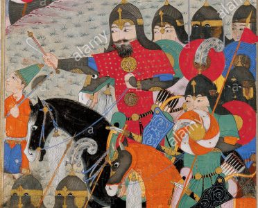
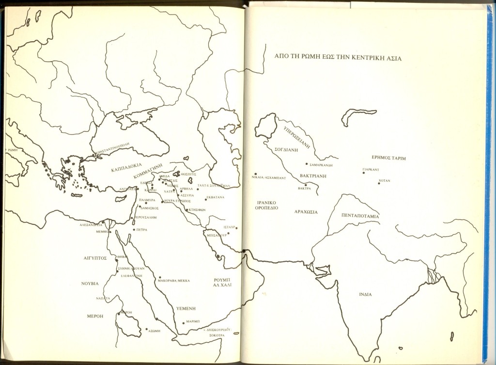
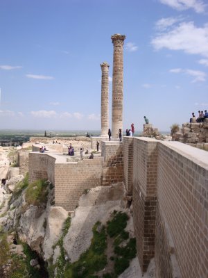
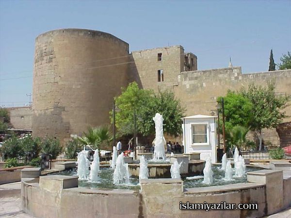
1. Edessa of Osrhoene Edessa of Osrhoene, today’s Urfa in South – Eastern Turkey, is the central point of the first chapter. Already we discover there all the fundamental characteristics and the major trends of Megalommatis’ itinerary narratives. After describing monuments and archeological remains, the author gives a great part of consideration and effort to present – in a very vivid way – several, selected moments of the Edessene past, i.e. various glorious pages of the history of Edessa of Osrhoene, as well as and the entire province of Harran.
The portrait of the rival, Egyptian and Babylonian, armies of Nechao and Nebukadnezzar observing each other from the opposite river shores of Euphrates at Karkhemish is very strong and truly impressive. Certainly, the greater area of Harran was the cross point par excellence between Mesopotamia, Syria, Phoenicia and Anatolia for thousands of years. Megalommatis refers to Harran and its monuments, moving throughout History, from Abraham’s crossing to the Islamic times.
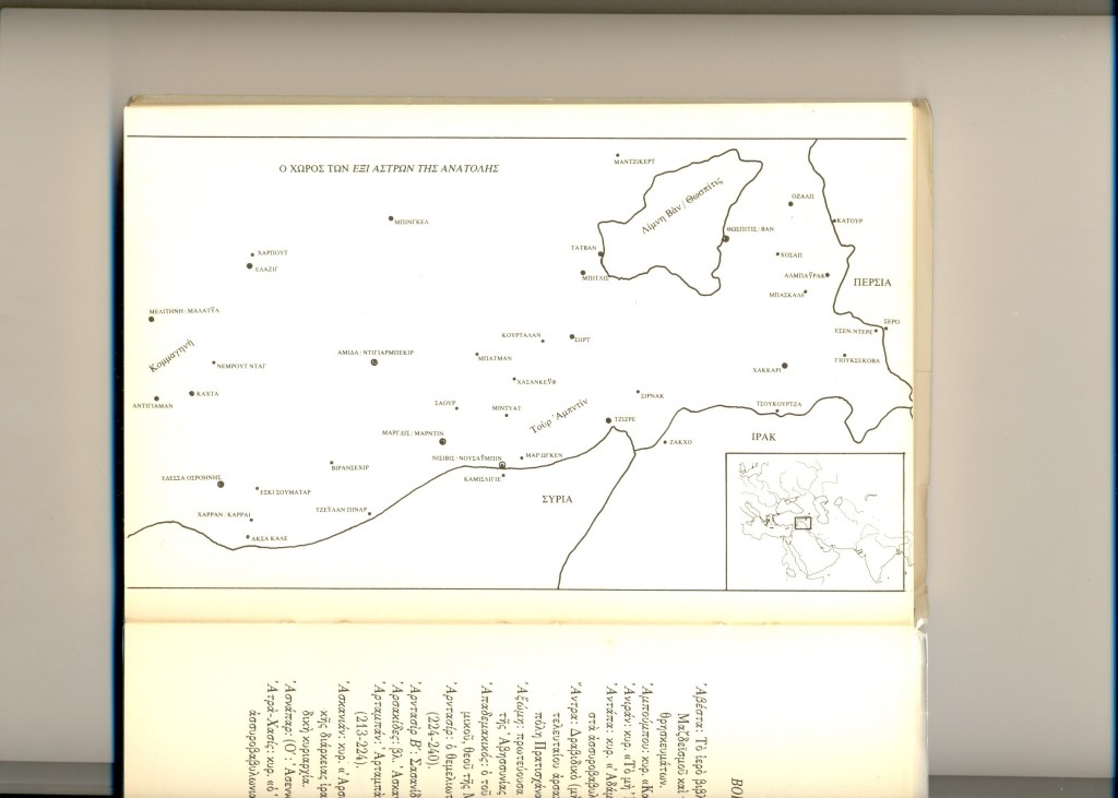
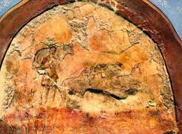
Absolutely fascinating are the descriptions of the Sabians, the famous astrosymbolists of Late Antiquity Sumatar. Muhammad Shamsaddin Megalommatis holds them as highly skillful mysticsinitiated in the greatest secrets pertaining to the End of Time, and to the arrival of the Messiah. The author refers to their voluntary dispersion which was attested several decades ago; he explains the otherwise mysterious development as an indication that the period prophesied as the End of Time has arrived, and he assures his reader that the Sabians, currently unidentified as dispersed in unknown locations, continue pursuing their highly evaluated work during the lifetime of the Messiah. The text turns therefore apocalyptic for the average reader, as the author insinuates that we are living at the times of the Messiah.
(Опубликовано в Афинах в 1994 году профессором Мухаммадом Шамсаддином Мегаломматисом)
1. Эдесса Столица Осроены
Эдесса Столица Осроены, сегодняшняя Урфа в Юго-Восточной Турции, является центральной точкой первой главы. Уже здесь мы обнаруживаем все основные характеристики и основные направления повествований о маршрутах Мегаломматиса. После описания памятников и археологических памятников автор уделяет большое внимание и старается представить – очень живо – несколько избранных моментов прошлого Эдессы, то есть различные славные страницы истории Эдессы и Осроены, а также и вся провинция Харран.
Портрет конкурирующих армий египетского фараона Нечао и вавилонского царя Небукаднеззара, которые наблюдали друг друга с противоположных берегов Евфрата в Кархемиш, очень сильный и поистине впечатляющий. Конечно, большая провинция Харран была точкой пересечения между Месопотамией, Сирией, Финикией и Анатолией – на протяжении многих тысяч лет. Мегаломматис относится к Харрану и его памятникам, которые перемещаются по всей истории от перехода Авраама до исламских времен.
Абсолютно захватывающими являются описания сабиан, знаменитых астросимволистов поздней античности Суматар. Мухаммад Шамсаддин Мегаломматис считает их высококвалифицированными мистиками, посвященными в величайшие тайны, относящиеся к Концу Времени и приходу Мессии. Автор ссылается на их добровольное рассеяние, которое было засвидетельствовано несколько десятилетий назад; он объясняет загадочное развитие, как показатель того, что наступил период, предсказанный как Конец Времени, и заверяет своего читателя, что сабиане, в настоящее время неопознанные и рассеянные в неизвестных местах, продолжают преследовать свою высоко оцененную работу в течение жизни Мессии. Поэтому текст становится апокалиптическим для обычного читателя, поскольку автор намекнул, что мы живем во времена Мессии.
Δείτε το βίντεο:
Эдесса, столица Осроены (Урфа, Юго-Восточная Турция): из книги проф. Мухаммада Шамсаддина Мегаломматиса «Шесть звезд Востока»
(Опубликовано в Афинах в 1994 году профессором Мухаммадом Шамсаддином Мегаломматисом)
1. Эдесса Столица Осроены
Эдесса Столица Осроены, сегодняшняя Урфа в Юго-Восточной Турции, является центральной точкой первой главы. Уже здесь мы обнаруживаем все основные характеристики и основные направления повествований о маршрутах Мегаломматиса. После описания памятников и археологических памятников автор уделяет большое внимание и старается представить – очень живо – несколько избранных моментов прошлого Эдессы, то есть различные славные страницы истории Эдессы и Осроены, а также и вся провинция Харран.
Портрет конкурирующих армий египетского фараона Нечао и вавилонского царя Небукаднеззара, которые наблюдали друг друга с противоположных берегов Евфрата в Кархемиш, очень сильный и поистине впечатляющий. Конечно, большая провинция Харран была точкой пересечения между Месопотамией, Сирией, Финикией и Анатолией – на протяжении многих тысяч лет. Мегаломматис относится к Харрану и его памятникам, которые перемещаются по всей истории от перехода Авраама до исламских времен.
Абсолютно захватывающими являются описания сабиан, знаменитых астросимволистов поздней античности Суматар. Мухаммад Шамсаддин Мегаломматис считает их высококвалифицированными мистиками, посвященными в величайшие тайны, относящиеся к Концу Времени и приходу Мессии. Автор ссылается на их добровольное рассеяние, которое было засвидетельствовано несколько десятилетий назад; он объясняет загадочное развитие, как показатель того, что наступил период, предсказанный как Конец Времени, и заверяет своего читателя, что сабиане, в настоящее время неопознанные и рассеянные в неизвестных местах, продолжают преследовать свою высоко оцененную работу в течение жизни Мессии. Поэтому текст становится апокалиптическим для обычного читателя, поскольку автор намекнул, что мы живем во времена Мессии.
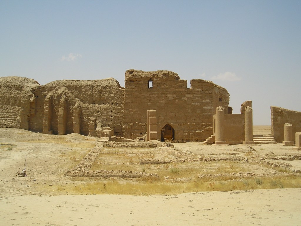
Η Δούρα Ευρωπός (Δοῦρα Εὐρωπός, Dura Europos, Дура Эвропос) είναι ένας από τους σημαντικώτερους αρχαιολογικούς χώρους όλου του κόσμου. Βρίσκεται στα ανατολικά άκρα της Συρίας, ακριβώς πάνω στην αριστερή (δυτική) όχθη του Ευφράτη, λίγο πριν ο ποταμός μπει στο Ιράκ – κάτι που σημαίνει ότι κάνουμε λόγο για τον μέσο ρου του Ευφράτη. Ο αρχαιολογικός χώρος βρίσκεται κοντά στο χωριό Σαλχίγιε, όχι μακριά από την τελευταία μεγάλη πόλη της Ανατολικής Συρίας Αμπού Κεμάλ.
Όπως το όνομά της δηλώνει, η πόλη ήταν αρχικά ένα ασσυροβαβυλωνιακό κάστρο (Ντουρ) στα δυτικά άκρα της Κεντρικής Μεσοποταμίας. Δούρα είναι η εξελληνισμένη μορφή του Ντουρ. Η επιπρόσθετη ελληνική λέξη προσδιορίζει το τεράστιο οπτικό πεδίο που προσφέρει ο παρά τον Ευφράτη λόφος πάνω στον οποίο αρχικά οι Ασσυροβαβυλώνιοι είχαν ανεγείρει ένα φρούριο. Ο χώρος προσφέρει ευρύτατη δυναυτότητα εποπτείας, συνεπώς προσφερόταν για μια σημαντική οχυρωματική θέση.
Στην μακραίωνη ιστορία της η Δούρα Ευρωπός ήταν η πόλη όλων των ορίων: αρχικά ανάμεσα στους Ασσύριους και τους Βαβυλώνιους. Η πόλη είναι το νοτιοδυτικό άκρο της Ασσυρίας και το βορειοδυτικό άκρο της Βαβυλώνας κατά την 2η προχριστιανική χιλιετία. Στα τέλη αυτής της χιλιετίας και στις αρχές της επόμενης, η Ντουρ και ο τριγύρω χώρος κατακλύσθηκαν από τους Αραμαίους που διασπάρθηκαν από τα νότια άκρα της Βαβυλώνας και τις ακτές του Περσικού Κόλπου μέχρι την Δαμασκό, την Κιλικία ή ακόμη την Λυδία όπως τεκμηριώνουν δίγλωσσες λυδικές – αραμαϊκές επιγραφές που έχουν σωθεί.
Ωστόσο, σήμερα, η Δούρα Ευρωπός δεν είναι αντικείμενο έρευνας των Ασσυριολόγων. Ο χώρος, του οποίου η ακμή ανάγεται στα σελευκιδικά, αρσακιδικά, και ρωμαϊκά χρόνια, είναι αντικείμενο έρευνας πολλών και διαφορετικών επιστημόνων. Η ανεύρεση αραμαϊκών, ελληνικών, λατινικών, παρθικών και περσικών επιγραφών ελκύει το ενδιαφέρον σημιτολόγων, ελληνιστών, λατινιστών και ιρανολόγων. Η τεράστια σημασία της καραβανούπολης ως κομβικού σημείου στους Ιστορικούς Δρόμους του Μεταξιού, των Μπαχαρικών και των Λιβανωτών την καθιστά αντικείμενο έρευνας όλων των ειδικών του Ρωμαϊκού Εμπορίου με την Κίνα.
OLYMPUS DIGITAL CAMERA
Όμως περισσότερο από τα προαναφερμένα, η ιστορική
σημασία της Δούρας Ευρωπού είναι ένα κάλεσμα για τους ιστορικούς θρησκειών,
τους θρησκειολόγους που ειδικεύονται
1- στον Μιθραϊσμό και ιδιαίτερα στην αποδοχή του
ανάμεσα στους Αραμαίους,
2- στην διάδοση ανατολικών θρησκειών, λατρειών,
μυθολογιών, θεουργιών, μυστικισμών και επιστημών στην Ρωμαϊκή Αυτοκρατορία και
την Μεσόγειο,
3- στον Ιουδαϊσμό και την διάδοση της αρχαίας
ιουδαϊκής θρησκείας ανάμεσα στους Αραμαίους (που χαρακτηριστικά εκπροσωπεί η
γνωστή Σαμαρείτιδα των ευαγγελικών περικοπών),
4- στην διατήρηση αρχαιοελληνικών και ρωμαϊκών
θρησκειών και λατρειών ανάμεσα στις ελληνικές και ρωμαϊκές κοινότητες του
σελευκιδικού και ρωμαϊκού κόσμου, και
5- στην διαμόφωση συγκρητικών μορφών θρησκειών με την
ανάμειξη στοιχείων πολλών, διαφορετικής προέλευσης, δογμάτων.
Οι χρόνοι της ακμής της Δούρας Ευρωπού τοποθετούνται στην
περίοδο από το 303 π.Χ., όταν ο Σέλευκος Νικάτωρ ανήγειρε εκνέου την πόλη ως
κεντρικό σημείο στον δρόμο που συνέδεε την Αντιόχεια με την Σελεύκεια επί του
Τίγρη (νότια της σημερινής Βαγδάτης), μέχρι την ιρανική σασανιδική επίθεση και
καταστροφή της πόλης το 256 μ.Χ., όταν ο Σαπούρ Α’ μετώκισε το σύνολο του
πληθυσμού στα ανατολικά κι άφησε την πόλη ως ερείπια να χαθεί κάτω από την άμμο
της ερήμου για σχεδόν 1700 χρόνια.
Τα πολλά ευρήματα, τα τείχη, οι πύργοι, τα τεράστια κτήρια,
οι πολλοί ναοί, το Μιθραίο, η Εκκλησία, η Συναγωγή, εντυπωσιακές τοιχογραφίες,
οι πολλές επιγραφές και τα λοιπά κειμενικά τεκμήρια (περγαμηνές) που
ανασκάφηκαν, ανασκάπτονται και θα ανασκαφούν στην Δούρα Ευρωπό κάνουν τον τόπο
αυτό ένα από τα μοναδικά στην Παγκόσμια Ιστορία δείγματα αυθεντικής
πολυπολιτισμικής κοινωνίας, η οποία αναπτύχθηκε από την εθελούσια συνεργασία
και συμβίωση πολλών διαφορετικών εθνών, κι όχι από τυχον παράξενη υποκίνηση,
τεχνητή υποδαύλιση, και υστερόβουλη επέμβαση. Ήταν μια φυσιολογική συνέπεια των
γενικωτέρων εξελίξεων στον ευρύτερο χώρο κι όχι ένα προγραμματισμένο και
προσχεδιασμένο τερατούργημα.
Στην Δούρα Ευρωπό ομιλήθηκαν διάφορες αραμαϊκές
γλώσσες και διάλεκτοι, καθώς υπήρχαν ντόπιοι Αραμαίοι αλλά και Παλμυρηνοί και
Χατραίοι (: από την Χάτρα, άλλη αραμαϊκή καραβανούπολη – κέντρο εμπορίου Δύσης –
Ανατολής, στο σημερινό βορειοδυτικό Ιράκ). Επίσης ομιλήθηκαν αρχαία ελληνικά,
λατινικά, παρθικά, ιουδαϊκά, μέσα περσικά, αρχαία υεμενικά, και αραβικά, καθώς
από κει περνούσε το εμπόριο από την Μεσόγειο προς το Ιράν, την Ινδία και την
Κεντρική Ασία, όπως επίσης και το εμπόριο από την Υεμένη και το Κέρας της
Αφρικής προς τον Καύκασο και περιοχές της Κεντρικής Ασίας.
Η Ιστορία της Δούρας Ευρωπού τεκμηριώνει κάτι το πολύ
σημαντικό: δεν χρειάζεται μια πόλη για να μείνει ως εξαιρετικά σημαντική στην
Ιστορία να είναι πρωτεύουσα ενός ισχυρού κράτους. Κι έτσι ήταν η ιστορία αυτού
του μοναδικού τύπου που λειτούργησε σαν χωνευτήρι πίστεων, παραδόσεων, δοξασιών
και μυστικισμών σε βαθμό που την αποκάλεσαν Πομπηία της Ερήμου.
Η Δούρα Ευρωπός παρέμεινε σελευκιδική από το 303 π.Χ.
μέχρι το 113 π.Χ. όταν την κατέκτησαν οι Πάρθοι, οι οποίοι την εκράτησαν μέχρι
το 114 μ.Χ., όταν επελαύνοντας προς τα ανατολικά την κατέλαβε ο Τραϊανός, ο μόνος
Ρωμαίος αυτοκράτορας που έφθασε στον μυχό του Περσικού Κόλπου και στα δυτικά
παράλια της Κασπίας. Οι Πάρθοι ανακατέλαβαν την πόλη το 117 μ.Χ. και την
διατήρησαν μέχρι το 165 μ.Χ. Τότε οι Ρωμαίοι την ανέκτησαν και την διατήρησαν,
ως ‘Αποικία’ (Colonia) από το 211 μ.Χ., μέχρι την
σασανιδική ιρανική κατάληψη του 256 μ.Χ. και καταστροφή της πόλης.
Έτσι, η Δούρα Ευρωπός υπήρχε πάντοτε μια πόλη ανάμεσα
σε δυο κόσμους: του Σελευκίδες της Συρίας και τους Αρσακίδες του Ιράν πρώτα,
και τους Ρωμαίους και τους Σασανίδες του Ιράν έπειτα. Με τους Ρωμαίους και
Μακεδόνες κατοίκους της, η Δούρα Ευρωπός παρέμεινε το ανατολικώτερο σημείο όπου
αρχαία ελληνικά και λατινικά ομιλούντο τον 3ο αιώνα στην Συρο-Μεσοποταμία.
Για την Δούρα Ευρωπό μπορούν να γραφούν
εγκυκλοπαίδειες. Είναι ο χώρος όπου σώζονται η αρχαιότερη εκκλησία, η
αρχαιότερη συναγωγή και το αρχαιότερο Μιθραίο δυτικά του Ιράν.
Δείτε το βίντεο:
Дура Эвропос: Многокультурный караванный город на
берегу Евфрата: арамейцы, греки, римляне и иранцы
Первоначально на месте Д.-Е. располагалась
древнеассир. крепость. В 300-280 гг. до Р. Х. Селевк I Никатор основал там
колонию македон. воинов, охранявших переправы через Евфрат на пути из 2 столиц
гос-ва Селевкидов – Антиохии-на-Оронте и Селевкии-на-Тигре. Приблизительно
после 113 г. до Р. Х. в составе Месопотамии Д.-Е. перешел под власть Парфии,
став важным форпостом в Сирии. Население города к I в. до Р. Х. было по
преимуществу арамейским. В 116 г. Д.-Е. был оккупирован войсками рим. имп.
Траяна, позже возвращен имп. Адрианом парфянам, в 165 г., во время парфянского
похода имп. Луция Вера, завоеван римлянами и включен в состав рим. пров. Сирия,
в 211 г. получил статус колонии. С рим. завоеванием Д.-Е. стал одним из
форпостов в войнах с Парфией, его гарнизон был увеличен за счет войск, базировавшихся
в Сев. Европе, было начато строительство оборонительных сооружений. С падением
Парфии и усилением гос-ва Сасанидов город неоднократно переходил из рук в руки.
В 256 или 257 г. крепость была разрушена войсками сасанидского царя Шапура I
(сохр. следы разрушений, останки воинов, погибших в подстенных подкопах). В
260-273 гг. Д.-Е. входил в состав гос-ва Пальмира, позже стал местом поселений
христ. отшельников, постепенно был поглощен пустыней.
В эпоху правления Селевкидов (возможно, раньше) город
был окружен зубчатой стеной со сторожевыми башнями (сохр. остатки 26), разделен
улицами на квадраты по античной Гипподамовой системе (судя по следам
неоконченных строительных работ, первоначальный план не был осуществлен;
основной план сохр. структуру эллинистического города). От главных Пальмирских
ворот (17-16 гг. до Р. Х.) начиналась широкая улица, на к-рой находилась агора;
по оси этой улицы в юго-вост. части города располагалась старая цитадель,
основанная греками как стратегион (резиденция стратега), на северо-востоке –
новая цитадель (времени Селевкидов, II в. до Р. Х.; перестроена и достроена в
парфянский период), у сев. оконечности города, у приречной стены,- резиденция
начальника рим. гарнизона (после 227).
От парфянского времени в Д.-Е. сохранились руины
цитадели и дворца, остатки жилых домов, руины храмов греч., местных вост. и
синкретических греко-сир. и греко-иран. божеств: Баала-Бела, Артемиды, культ
к-рой слился с культом иран. Нанайи (40-33 гг. до Р. Х., перестроен при
парфянах из греч. храма, служил центром офиц. культа Д.-Е. в греч., парфянский
и рим. периоды), сир. богини Атаргатис (31-2 гг. до Р. Х., к востоку от храма
Артемиды-Нанайи, построен по сходному плану), Зевса Кириоса (Господа), Зевса
Теоса (Бога) (114 г., к северу от кардо), Зевса Мегиста (Величайшего) (169 г.,
на месте древнего храма 95-70 гг. до Р. Х., имеет смешанные греко-парфянские
черты), т. н. храма Пальмирских богов, или храма Гадде, посвященного 2
пальмирским божествам – Баалам (до 159, между храмом Атаргатис и агорой Д.-Е.),
Адониса и др. Нек-рые из храмов были расписаны, в руинах обнаружены рельефы и
статуи. К рим. времени относятся укрепления в военном квартале и возведенные на
месте жилого квартала парфянского времени строения, предназначенные для
гарнизона, занявшие 1/4 территории города, где располагались термы и храмы. В
храмах Д.-Е. обнаружено множество вотивных рельефов, стилистически близких к
пальмирским, при полном их отсутствии в погребальных комплексах.
Открытые в Д.-Е. жилые дома (по типу и архитектурному
декору греч. или эллинизированные, рим. или отмеченные рим. влиянием – «дворец
Лисия» с портиком на стороне террасы, обращенной к Евфрату; «дворец начальника
пограничной стражи» в военном квартале) и многочисленные святилища имеют
месопотамский облик – комплекс помещений вокруг главного двора, окруженного
стеной. За стенами Д.-Е. расположены некрополи, представляющие собой подземные
захоронения с неск. погребальными башнями.
В 256 г., видимо незадолго до осады армией Сасанидов,
застроенный квартал шириной ок. 12-15 м, прилежащий к стене, высота к-рой
составляла 10 м, был засыпан рим. солдатами битым кирпичом, благодаря чему до
наст. времени сохранились храм Пальмирских богов, митреум (храм Митры), дом
рим. типа с «домовой церковью», синагога (с 245).
Остатки крепости Д.-Е. были обнаружены 30 марта 1920
г., когда при рытье траншей брит. солдаты увидели росписи храма Пальмирских
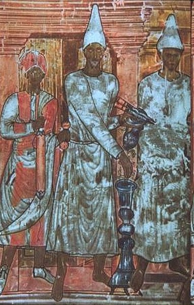
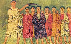
богов с изображением жрецов и римского легионера, приносящих жертвы богам.
Эксперт археолог Дж. Г. Брестед, 1-м ознакомившийся с городищем, предположил,
что оно известно по лит. источникам как Д.-Е. В 1922-1923 гг. раскопки Д.-Е.
вела франц. экспедиция под рук. Ф. Кюмона (в публикации 1926 г. он подтвердил,
что обнаруженный город является Д.-Е.), в 1928-1937 гг.- франко-амер.
экспедиция под рук. М. И. Ростовцева из Йельского ун-та; раскопки были
остановлены в связи с началом второй мировой войны. В сер. 80-х гг. раскопки
возобновлены франко-сирийской экспедицией под рук. П. Лериша.
Ду́ра-Е́вропос [греч. Ϫοῦρα Εὔρωπος], древний город на берегу р. Евфрат, у одной из главных дорог,
связывавших Дамаск с Месопотамией; в наст. время – городище близ дер.
Эс-Салихия (Вост. Сирия); музей под открытым небом. Совр. название условно и
образовано из слияния арам. duru – стена, крепость (название бытовало среди
местного населения) и македон. топонима Europos (офиц. название в греко-рим.
документах).
Памятники материальной культуры и эпиграфики,
сохранившиеся в Д.-Е., доказывают, что в парфянский период его население было
сирийским, арабским и иранским. Этническая картина усложнилась при Селевкидах с
поселением греков и македонян, затем – с рим. завоеванием. Различные религии
были принесены в Д.-Е. греками, рим. воинами (в основном германцами из Сев.
Европы), арабами из Пальмирского оазиса, степными кочевниками, парфянами;
население разделялось по вероисповеданию, о чем свидетельствуют надписи: в
синагоге они выполнены на арам. языке, в «церкви» – на греческом.
Dura Europos
(“Fort Europos”) is a ruined Hellenistic-Roman walled city built on
cliff 90 meters above the banks of the Euphrates river. It is located near the
village of Salhiyé, in today’s Syria. Destroyed by war and abandoned in the 3rd
century AD, it lie hidden until its rediscovery in 1920. Excavations have
revealed, among other important ruins, the oldest synaogogue and oldest church
ever found. Due to its remarkable preservation and has sometimes been dubbed
the “Pompeii of the Syrian Desert.”
Dura Europos
was founded in 303 BC by the Seleucids (Alexander the Great’s successors) on
the intersection of an east-west trade route and a north-south trade route
along the Euphrates. The new city, named for the birthplace of Seleucus I
Nicator, controlled the river crossing on the route between Antioch on the
Orontes and Seleucia on the Tigris. Dura Europos was part of a network of
military colonies intended to secure Seleucid control of the Middle Euphrates.
Dura was
rebuilt as a great Hellenistic city in the 2nd century BC, with a rectangular
grid of streets arranged around a large central agora, was formally laid out.
Its location on a major crossroads made it a very cosmopolitan city:
inscriptions in many languages have been found here and the religious buildings
of pagans, Jews and Christians stand side by side.
Dura Europos
later became a frontier fortress of the Parthian Empire and it was captured by
the Romans in 165 AD. In the early 200s AD, the famed house-church and
synagogue were built at Dura Europos. There was also a Mithraeum, a Temple of
Bel and a Temple of Adonis in the multi-cultural city.
Dura Europos
was abandoned after a Sassanian siege in 256-257. In a last-ditch attempt to
save the city, the synagogue was filled in to make a fortress, thereby ensuring
its preservation. The city eventually became covered in shifting sands and
disappeared from sight.
Although the
existence of Dura-Europos was long known through literary sources, it was not
rediscovered until British troops under Captain Murphy made the first discovery
during the Arab rebellion in the aftermath of World War I. On March 30, 1920, a
soldier digging a trench uncovered beautifully preserved frescoes. The American
archeologist James Henry Breasted, then at Baghdad, was alerted. Major
excavations were carried out in the 1920s and 1930s by French and American
teams.
The first
excavations of the site, undertaken by Franz Cumont and published in 1922-23,
identified the site as Dura-Europos and uncovered a temple before renewed
hostilities in the area closed it to archaeology. Later, renewed campaigns
directed by Michael Rostovtzeff funded by Yale University continued until 1937,
when funds ran out with only part of the excavations published. World War II
then interfered.
Since 1986
excavations have resumed. Not the least of the finds were astonishingly
well-preserved arms and armour belonging to the Roman garrison at the time of
the final Sassanian siege of 256. Finds included painted wooden shields and
complete horse armours, preserved by the very finality of the destruction of
the city that journalists have called “the Pompeii of the desert”.
The largely
mud-brick architecture of Dura Europos does not compare to Palmyra visually,
but the dramatic remains of the walls and siegeworks combined with precipitous
views over the green valley of the Euphrates makes for a striking sight. And
arguably, Dura surpasses Palmyra in historical and religious importance.
Dura-Europos
was a cosmopolitan society: over a hundred parchment and papyrus fragments and
many inscriptions have been discovered at the site, which include Greek, Latin,
Palmyrenean, Hebrew, Hatrian, Safaitic, and Pahlavi.
Three of the
covered homes in Dura Europos had been converted for use as religious
buildings. One had become a Mithraeum, dedicated to the worship of the god
Mithras, who was popular with Roman soldiers. Another had undergone structural
modifications to become a Jewish synagogue. The third home had been converted
to a Christian church. The synagogue and church are the oldest that have been
found anywhere, and are also remarkable in that they were built very close to
each other at virtually the same time.
The world’s
oldest preserved Jewish synagogue in Dura-Europos has been dated by an Aramaic
inscription to 244. It was preserved when it was filled with earth to
strengthen the city’s fortifications against a Sassanian assault in 256. It was
uncovered in 1935 by Clark Hopkins, who found that it contains a forecourt and
house of assembly with frescoed walls depicting people and animals, and a Torah
shrine in the western wall facing Jerusalem.
The
synagogue’s painted walls and roof of baked-brick tiles were transported across
the desert 300 miles away to Damascus, where it became the centrepiece of the
National Museum built in 1934. Yale had to settle for a copy.
Dura-Europos
also boasts the oldest known Christian church. It was dismantled and
re-constructed at Yale University in the early 1930s, so there isn’t much to
see at Dura-Europos but basic foundations.
The church
occupied a typical Roman upper-class house centered around a columned courtyard
with an open room (atrium). In the center of the courtyard was a pool
(impluvium). At the opposite end from the entrance was a raised area (tablinum)
containing a table and used by the family as a reception area and for
ceremonial functions.
Scholars
speculate that the congregation gathered around the pool, which was used for
baptism. In the tablinum sat the bishop, who celebrated the Eucharist
(communion) at the table. This arrangement provides a basis for the liturgical
arrangement of later basilica churches.
The murals
of the Dura Europos chuch were painted between 232 and 256 AD and are among the
earliest examples of Christian art that survives today. The mural of the
Healing of the Paralytic contains the earliest image of Jesus found anywhere.
In 1933, an
important fragmentary text was unearthed at Dura Europos that contained a
previously unknown Greek harmony of the gospels, dated to the late 2nd century.
This has been important for early Christian studies, particular those of Tatian’s
Diatessaron, a more well-known gospel harmony.
Excavations
have also revealed the ruins of pagan temples dedicated to Greek, Roman and
Palmyrene gods, including a Temple of Bel (a Semitic god) and a Temple of
Adonis (a Greek god).
Preserved in
the Temple of Adonis was a 2nd-century dedicatory inscription, which is now in
the Louvre Museum. Other finds from Dura can be seen at the National Museum in
Damascus and elsewhere.
Δούρα Ευρωπός: Το Μέγιστο Πολυπολιτισμικό Κέντρο της Ιστορίας – Αραμαίοι, Έλληνες, Ρωμαίοι, Ιρανοί
Περισσότερα:
Η Δούρα Ευρωπός είναι αρχαία πόλη, στις όχθες του
ποταμού Ευφράτη, στα σύνορα μεταξύ Μεσοποταμίας και Συρίας. Ιδρύθηκε, ως
στρατιωτική αποικία, μετά το πέρας του Βαβυλωνιακού πολέμου (311-309 π.Χ.) από
τον στρατηγό Νικάνορα (λογικά είναι το ίδιο πρόσωπο που ίδρυσε την Έδεσσα και
την Αντιόχεια Μυγδονική) για λογαριασμό του κυρίου του Σελεύκου Α΄ Νικάτορος
(358-281 π.Χ.), ενός εκ των βασιλικών φίλων του Μεγάλου Αλεξάνδρου. Η ονομασία
Ευρωπός προέρχεται από την ομώνυμη πατρίδα του Σελεύκου στην Μακεδονία.
Το 253 ή 256 μ.Χ. καταστράφηκε από τους Πέρσες και
σκεπάστηκε από την άμμο. Όταν, στις δεκαετίες 1920 – 1930, η αρχαιολογική
σκαπάνη την επανέφερε στο φως ο Mikhail Rostovtzeff την είχε αποκαλέσει
«Πομπηία της ερήμου». Η ανακάλυψή της έγινε τυχαία από το βρετανικά στρατεύματα
το 1920.
Dura-Europos
(Greek: Δοῦρα Εὐρωπός), also spelled Dura-Europus, was a Hellenistic, Parthian and Roman
border city built on an escarpment 90 metres (300 feet) above the right bank of
the Euphrates river. It is located near the village of Salhiyé, in today’s
Syria. In 113 BC, Parthians conquered the city, and held it, with one brief
Roman intermission (114 AD), until 165 AD. Under Parthian rule, it became an
important provincial administrative center. The Romans decisively captured
Dura-Europos in 165 AD and greatly enlarged it as their easternmost stronghold
in Mesopotamia, until it was captured by the Sasanian Empire after a siege in
256–57 AD. Its population was deported, and after it was abandoned, it was
covered by sand and mud and disappeared from sight.
Dura-Europos
is extremely important for archaeological reasons. As it was abandoned after
its conquest in 256–57 AD, nothing was built over it and no later building
programs obscured the architectonic features of the ancient city. Its location
on the edge of empires made for a co-mingling of cultural traditions, much of
which was preserved under the city’s ruins. Some remarkable finds have been
brought to light, including numerous temples, wall decorations, inscriptions,
military equipment, tombs, and even dramatic evidence of the Sassanian siege.
Ду́ра-Эвропо́с (греч. Δοῦρα Εὐρωπός) — античный город на Евфрате
(вблизи современного города Сальхиях в Сирии), существовавший примерно с 300
года до н. э. до 256 года. Получил известность в связи с археологическими
находками и хорошо сохранившимися древними фресками. Дура на арамейском
означает «крепость».
Город был основан царём Селевком I Никатором около 300 года до н.
э. среди многих других и просуществовал более 550 лет. Примерно в 100 году до
н. э. перешёл под власть Парфянского царства, а с 165 года — Римской империи. В
римское время Дура-Европос был крупным торговым центром, и большинство
археологических находок относятся к этому периоду времени. В 256 году захвачен
войсками Сасанидов и заброшен.
Селевк, диадох Александра Македонского, выбрал для
поселения своих солдат заброшенную ассирийскую крепость на дороге из Дамаска в
Междуречье и дал ей имя «Дура». Римляне назвали город «Дура-Европос», потому
что местная аристократия состояла из потомков македонцев, то есть они
подчеркнули что город управляется «европейцами» из Македонии. Крепость стояла
на высоком берегу среднего Евфрата, защищённая с трёх сторон крутыми обрывами,
а четвёртая сторона, противоположная от реки и примыкающая к пустыне, была
обнесена длинной прямой стеной с башнями. Размеры города составляют примерно
700 на 1000 м.
Город регулярно спланирован (прямо пересекающиеся
улицы) в селевкидское время, к которому относятся агора, остатки храмов,
цитадель. Со временем гражданское население стало превалировать, и крепость
превратилась в захолустный городок, выросший вокруг рыночной площади. Однако
население можно назвать гражданским лишь условно. В военное время земледельцы
вставали в строй, образуя сословие так называемых клерухов. В социальном отношении
жители делились по родам, как и в Македонии. Земля клерухам давалась в
пожизненную аренду за их службу или службу их детей, оставаясь царской
собственностью.
Dura Europos,
ruined city on the right bank of the Euphrates between Antioch and Seleucia on
the Tigris, founded in 303 B.C.E. by Nicanor, a general of Seleucus I. It
flourished under Parthian rule. The site is in modern Syria, on a plateau
protected on the east by a citadel built on bluffs overlooking the river, on
the north and south by wadis, and on the west by a strong rampart with powerful
defensive towers. Its military function of the Greek period was abandoned under
the Parthians, but at that time it was the administrative and economic center
of the plain extending 100 km between the confluence of the Ḵābūr and
Euphrates rivers and the Abū Kamāl gorge to the south.
I. Archaeology
and History
Initial
archeological exploration of the city took place in 1920-22, under the direction
of Franz Cumont and the sponsorship of the Académie des Inscriptions et
Belles-Lettres in Paris. From 1929 to 1937 Yale University and the Académie
sponsored excavations under the initiative of M. I. Rostovtzeff, who published
Dura-Europos and Its Art, a synthesis of the history of the town and of its
civilization, formed from Greek, Semitic, and Iranian components. This work has
served as the basis for all subsequent studies of the site. In fact, however,
understanding of Dura Europos depended mainly on written materials (parchments,
papyri, inscriptions, and grafitti; see ii, below), paintings, tombs, and
portable objects (e.g., coins, bronzes, and lamps) from the excavations, and
very little attention has been paid to the architectural remains. Although
nearly a third of the town has been excavated, a large number of buildings have
been published only summarily or not at all. It therefore became necessary to
resume the work of publication, and for this reason the Mission Franco-Syrienne
de Doura-Europos was formed in 1986 under the joint direction of the author and
Assad Al-Mahmoud; the major objectives are to reexamine the archeological data,
to make available the entire mass of documentation from previous excavations,
as well as to save the monuments from destruction.
Dura Europos
was brought into the Iranian cultural sphere after the Parthian conquest in
about 113 B.C.E. (Bellinger; Welles). This domination lasted three centuries,
interrupted by a Roman occupation in 115-17 C.E., during Trajan’s expedition to
Ctesiphon. In 165 Dura was conquered by Avidius Cassius and became a stronghold
in the Roman defensive system along the eastern frontier of the empire.
Nevertheless, despite an impressive effort to reinforce its defenses, the town
was unable to withstand the great offensive launched by the Sasanian Šāpūr I
(240-70) in 256; it was taken after a bitter siege, and the population was deported,
thus putting an end to the town’s existence.
The Parthian
period
According to
recent discoveries, Dura Europos, originally a fortress, was constituted as a
city only in the late Hellenistic period and had been only sparsely populated
throughout the Greek period. It was under the Parthians, however, that the city
assumed its essential aspect, as revealed by the excavations, a configuration
only partly modified by the Roman occupation, except for transformation of the
northern sector into a Roman camp. Recent work by the Mission Franco-Syrienne
has permitted some refinement of this picture; certain buildings that had
formerly been attributed to the Parthians can now be dated to the Hellenistic
period. For example, according to Armin von Gerkan, the cut-stone
fortifications of Dura Europos had been built by the Parthians, fearful that
the Greek wall of unbaked bricks would be insufficient against a Roman attack.
Only the northern section of the original western wall survived, which he took
as proof that the project had been rendered unnecessary by the peace concluded
between the Parthians and Augustus in 20 B.C.E. (pp. 4-51). This conclusion was
based more on probabilities extrapolated from the reports of ancient historians
than on archeological discoveries and has been contradicted by the results of
recent soundings and clearing of earlier trenches. It is now clear that it was
the Greeks themselves who built the stone fortifications, in the second half of
the 2nd century B.C.E., and that the use of mud bricks resulted from the
imminent threat from the Parthians, which forced the builders to finish the
wall with more easily obtained material (Leriche and Mahmoud, l990). Similarly,
the reconstruction of the palace of the strategus and its extension to the
north, as well as construction of the second palace in the citadel, which shows
a number of similarities, had been attributed to the Parthian period, but
recent excavations in the interior and at the base of the facade of the former
building have revealed that it belongs to the 2nd century B.C.E., that is, the
Greek period. In a recent study Susan Downey (1988) has also called into
question the restoration of one palace with an ayvān, which was suggested in
the Yale publications and would imply a Parthian construction.
The Parthian
period thus appears to have been primarily a phase of expansion at Dura
Europos, an expansion favored by abandonment of the town’s military function.
All the space enclosed by the walls gradually became occupied, and the
installation of new inhabitants with Semitic and Iranian names alongside
descendants of the original Macedonian colonists contributed to an increase in
the population (Welles et al.). In his celebrated Caravan Cities Rostovtzeff
had argued that this prosperity could have resulted from the town’s position as
a trading center and caravan halt, but this hypothesis has been abandoned, for
nothing uncovered by the excavations has confirmed it. Instead, Dura Europos
owed its development to its role as a regional capital, amply illustrated by
the contents of inscriptions, parchments, and papyri.
In the
Parthian period Greek institutions remained in place (Arnaud), and the
property-zoning scheme established in the Hellenistic period was respected in
new construction; that is, buildings were kept within the limits of
pre-existing blocks 35 x 70 m laid out uniformly over the entire surface of the
plateau, even to a large extent in the interior wadis. The only exceptions were
the quarter of the town southeast of the citadel, which had apparently already
been occupied before the division into lots, and a sector of the agora that had
been invaded by domestic buildings. The ramparts were neglected: Domestic trash
accumulated along the periphery, finally forming a mass so thick that it
prevented access to certain towers on the western wall.
The
architecture of the Parthian period was characterized by a progressive
evolution of Greek concepts toward new formulas in which regional traditions,
particularly those derived from Babylonia, played an increasing role. These innovations
affected both religious and domestic buildings. No secular public building is
known to have been built during the Parthian period, with the possible
exception of a bath constructed of cut stone in the northeast sector of the
town. The evolved Parthian forms generally persisted into the Roman period,
except for buildings in the Roman camp in the northern third of the town, for
example, the palace of the Dux Ripae and the praetorium.
The
architecture of private dwellings varied in detail according to the wealth of
the owner. The systematic layout of the Greek city, in which each house was
supposed to cover one-eighth of a block (ca. 300 m2), was abandoned or modified
through subdivision and consolidation resulting from sales or inheritance
(Saliou). The smallest houses covered one quarter or even less of a Greek lot,
whereas other, more luxurious examples might cover up to half a block. But the
organizing principle of the house remained fundamentally the same: The street
door, often situated at a corner of the house, opened onto a corridor leading
into a central courtyard, which provided access and light to the various rooms
of the house. The principal room, the andrón, was usually situated on the south
side, opening to the north, and was surrounded on all four walls by a masonry
bench; it served as a reception room (Allara). Some houses incorporated
columns, but gabled roofs disappeared in favor of terraces, rooms became
irregular in shape, and several houses had second stories.
Religious
architecture underwent a comparable evolution, traceable through numerous
excavated buildings: the temples of Artemis Nanaïa II and Zeus Megistos II, the
necropolis temple, and the temples of Artemis Azzanathkona, Zeus Kyrios,
Atargatis, Bel, Aphlad, Zeus Theos, Gad, and Adonis. This architecture diverged
more and more from the hypothetical Greek model, if in fact such a model had
ever been introduced at Dura Europos (Downey, 1988, p. 176). All the temples of
the Parthian period have the same basic plan, with variations in detail. A
generally square temenos is enclosed by a blank wall; the naos stands at the
back of the interior courtyard facing the entrance. Against the interior face
of the enclosure wall are a series of rooms for service or secondary cults,
usually built by donors. When the naos is set against the back wall of the
temenos, a narrow space is left between them to provide a separation of the
cella from the exterior world. The building is small, usually square in plan,
and raised on a podium of two or three steps, with one or more altars in front.
The interior is divided in two: the pronaos, which occupies the full width of
the building and is sometimes furnished with tiers of benches on either side of
the entrance, and the cella, usually flanked by two chapels or lateral
sacristies. The cult image on the wall opposite the entrance, either mounted on
a pedestal or painted directly on the surface. All that remains from the Greek
tradition is the occasional presence of a columned facade in front of the
temple or porticoes along the sides of the courtyard, as at the temple of Bel.
It is thus
clear that at Dura Europos entirely original architectural formulas were
perfected during the Parthian period, in both religious and domestic
constructions; the Babylonian element predominated, though with a certain Greek
dressing, but no unequivocal Iranian influence appears. The formula for
religious buildings was followed in all temples, whatever the form of worship
to which they were consecrated, Greek or Semitic.
The only
Iranian cult known at Dura Europos was that of Mithra, which paradoxically had
been introduced into the city by Roman troops in 168. The mithraeum, located
near the western wall in the Roman camp, belongs to the type dedicated to the
cult throughout the Roman world and has no features in common with the other
religious buildings at Dura Europos, except that it stands on a podium. It
appears to have been a single room of modest dimensions with a bench on each of
the longer sides; above the central aisle there was a raised ceiling with a
clerestory. At the end of the room was a niche containing two cultic
bas-reliefs with an altar before them. The entire surface of the room was
covered with painted decoration: scenes from the life of Mithra,
representations of magi and the zodiac around the bas-reliefs in the niche, and
mounted hunting scenes on the side walls.
Although
Iranian influence is difficult to find in the architecture of Dura Europos, in
figurative art it is much more pronounced. In fact, owing to landfill that
preserved religious buildings along the western wall (see below), Dura has
provided the main evidence of a decorative art that seems to have developed in
Parthian domains, reflecting a synthesis of the traditions of the ancient Near
East (linear drawing, two-dimensional forms, stiff poses) and the Hellenic
world (the use of architectural decoration and friezes, types of dress). Furthermore,
in religious settings, those most fully represented, the principle of “Parthian
frontality” prevailed. This convention, according to which all figures, human
or divine, face directly forward, with eyes fixed on the spectator, made its
appearance at Dura very early, in the oldest painting, of the sacrifice of
Conon, in the temple of Bel (probably 1st century C.E.). It persisted until the
destruction of the city, as attested in the frescoes of the synagogue, dating
from 245. It was equally apparent in sculpture and terra-cottas (except for a
statue of Artemis with the tortoise, which comes from a Hellenistic center)
and, for example, in two reliefs of the Gads of Dura and Palmyra. On the other
hand, in frequent narrative scenes of combat and hunting on horseback, like
those in the mithraeum, the horses and wild beasts are portrayed in a flying
gallop, a characteristic that was to be developed in Sasanian art.
The siege of
Dura Europos
The Sasanian
siege of Dura Europos in 256 brought an end to the town’s existence and
immobilized Šāpūr’s army for several months. The determined resistance put up
by the inhabitants forced the assailants to adopt various siege tactics, which
eventually resulted in conquest of the city; the defensive system, the mines,
and the assault ramp were left in place after the deportation of the
population, which permits modern investigators to gain an exact idea of the
military techniques of the Sasanians and the Romans in the mid-3rd century.
It is not
known where the Sasanians located their camp, but traces of their operations
against the city wall still survive (du Mesnil du Buisson). To guard against
the attack, which was clearly expected from the time that the Sasanian empire
was established, the Romans had heightened and reinforced the external faces of
the western and northern ramparts by masking them with thick layers of fill
covered by a mud-brick glacis and thus burying the buildings along the inside
of the wall. The Persians undermined towers 19 and 14 on the western wall in
order to bring them down, but, owing to the filling and the glacis, the towers
were not really destroyed. At the southeast corner of the town they built an
assault ramp 40 m long and 10 m high against the wall to permit troops to
enter; it consisted of a mass of fill packed between two walls of brick and
paved with baked bricks, which made it possible to move a siege machine close
to the wall. Two tunnels, each wide enough to permit several men to advance
abreast, were dug near the body of the ramp. There is no surviving textual
description of the siege of Dura Europos, but Ammianus Marcellinus’ account of
the siege of Amida a century later, in which the same techniques were used,
permits reconstruction of the operations at Dura; the main siege weapons were
catapults, movable towers, and even elephants. Clearly the Sasanian armies had
a sophisticated knowledge of siege techniques.
The
discovery of the body of a Sasanian soldier in one of the trenches has also
yielded precious information. He was equipped with a coat of mail, a sword
ornamented with a jade disk of Central Asian type, and an iron helmet made in
two halves with an iron crest running vertically down the center of the front,
of clearly Mesopotamian and Iranian origin. This type of helmet served as a
model for those adopted in the Roman empire in the 3rd century (James).
The
chronology of the siege operations has given rise to a debate that is still far
from having been resolved. The discovery of Pahlavi inscriptions on the
frescoes of the synagogue does not prove that the town had first been occupied
by the Sasanians during a campaign in 253, three years before the final siege.
It is also improbable that a house near the triumphal arch on the main street,
in which there was a fresco of Sasanian type showing a fight between
cavalrymen, belongs to this putative first occupation. It seems now that this
fresco, several ostraca in Pahlavi found in the palace of the Dux Ripae (Figure
30/13), and the tombs discovered in the town and along the river resulted from
temporary installation of a small Persian detachment in the town after the
victory of 256 (MacDonald; Leriche and Al Mahmoud, 1994).
Τις βιβλιογραφικές παραπομπές μπορείτε να βρείτε εδώ:
Dura Europos
– The Life, Death and Resurrection of an ancient city – Syria
I traveled
to Dura Europos just before the outbreak of the Syrian civil war and were one
of the last to see this magnificent site before it was destroyed.
Dura Europos
was a Hellenistic, Parthian and Roman border city built on an escarpment above
the Euphrates river in eastern Syria.
It was
conquered in 114 AD and finally captured in 165 AD by the Romans (who greatly
enlarged it as their easternmost stronghold in Mesopotamia) and destroyed after
a Sassanian siege in 257 AD. After it was abandoned, it was covered by sand and
mud and disappeared from sight.
Abandoned
after its conquest in 256–7 AD, nothing was built over it and no later building
programs obscured the architectonic features of the ancient city. Its location
on the edge of empires made for a co-mingling of cultural traditions, much of
which was preserved under the city’s ruins.
Some
remarkable finds have been brought to light, including numerous temples, wall
decorations, inscriptions, military equipment, tombs, and even dramatic
evidence of the Sassanian siege during the Imperial Roman period which led to
the site’s abandonment.
After it has been severely looted by the Islamic State in the ongoing Syrian Civil War, it was demolished by ISIS.